The journey - four friends, an I-30 Hyundai, 4 overnight bags, 4 small folding chairs, 1 small esky [arm rest back seat], 2 thermos's, 2 shopping baskets of plates, cutlery, table cloth, tea and coffee, maps and a list of things to do and see over 8 nights and 9 days.
It was an amazing, eye opening journey of big skies, vast plains and marvellous rivers plus, just so much more.
This posts is of the skies, plains and rivers.
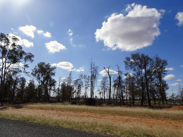
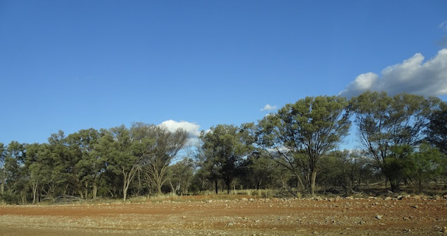
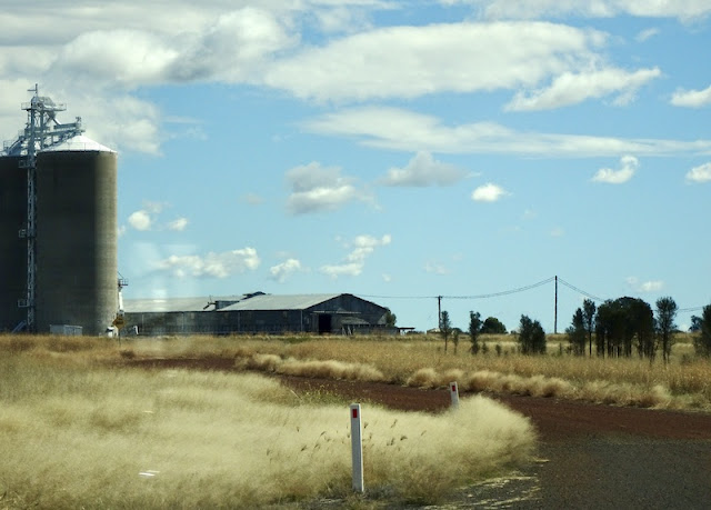
I have tried to post photos of the terrain between each of the rivers. These are not of great quality as they were taken from a fast moving car, on most occasions. The terrain changed constantly but the view was always to the far, far distance. The green fields are growing wheat, lucerne, mung beans, chick peas etc. They were huge and had huge rectangular, earthen, irrigation storage dams. The scale of the farms was just mind boggling, especially as the opposite side of the road was often quite arid. The grasses beside the road were shimmering and beautiful. We rarely saw sheep and cattle, for the height of the grass. Mornings saw crystal clear skies. By mid morning, puffy, pure white clouds began to chase one another across the horizon. Watching them was as fascinating as watching the ever changing view across the plains.
This is winter in Oz. Temperatures for us ranged from 5C to 17C and 10C to 22C. The previous week some areas had dropped to -7C overnight. In summer, it is rarely below 30C and can hover around the 40C for days, with little relief over night.
Where we drove on our 2965 km journey. [ Click on the map to see it more clearly.]
Distances each day.
River 1 - Condamine, Warick, still suffering from mild, drought conditions.
River 2 - Macintyre River, Goondiwindi. Early morning with wonderful reflections and birdlife.
Irrigation channel beside the grain.
River 3 - Moonie River, Nindigully Pub
River 4 - Balonne River, St George. Dusk, sunset, early morning.
River 5 - at Bollon on the Wallam in Balonne. [shire]
River 6 - Warrego, Cunnmulla, mid morning.
River 6b - Warrego at The Beach, Wyandra.
River 6 c - Warrego, Charleville.
No 7 - Sadliers Waterhole on Hamburg Creek, Morven.
River 8 - Mitchell at Mitchell, sunset, at the weir.
Flowing in town.
No 8 - Bungill Creek, Roma, a tributary of the Condamine. This is a waterhole in the Bushland Park.
No 9 - Dogwood Creek, Miles, sunset.
River 10 - Dawson, Taroom, midmorning walk at Stony Creek Crossing.
And back to the Condamine at Chinchilla.
In the early 1900's cactus almost wiped out agricultural industry.
Bunya Mountains at the end of Day 8. Leanne is pointing to the far, far distances we have travelled. RHS - The plains travelled.
Sunset colours and views from the Kingaroy Lookout. We are definitely back in coastal, hilly Queensland.
We were most certainly impressed with these rivers, whose long journey of approximately 4000 kms [I can't find a definite distance] to the Southern Ocean, has just begun. The journey has been hampered by drought and trying to regulate irrigation supply along its full length. Our journey was through country that had received drought breaking falls of rain earlier this year, making the rivers look healthy. A friend of mine reports that it was a very different picture last year.
I would love to read your comment.
Part 2, of roads, animals and picnics will hopefully follow soon.


It seems like a well-planned excursion. It's probably no surprise that the photos I liked the most were of the dynamic, dramatic skies.
ReplyDeleteKim, I often thought of you and the Kansas plains.
ReplyDeleteThose skies appear to go on forever. Then again, they really do. It’s Australia!
ReplyDeleteI can only imagine how drought changes the landscape.
The temperatures you mention for winter would be a dream for us but the summer temperatures...
We commented quite often at how heroic the early explorers were in mapping the outback, with basic food supplies, English clothing and our summer temperatures.
DeleteHooray! A girls trip! I enjoyed all your photos, especially the sunset ones.
ReplyDeleteYeah, a Girls Trip! It was just the best time. The sunsets were lovely but didn't give us the dramatic colours we were expecting. Not that we were complaining. Every day was perfect.
ReplyDeleteThat is a great trip. I have done most of those places so it was lovely to revisit them with you. You would have had a chance to see it without the myriad of nomads from the south.
ReplyDeleteThe numbers were down I assume, but the free campsites still looked pretty busy.
DeleteA great journey yo took, Helen, filled with big skies and big rivers. If you lived in Victoria now this trip would be impossible wouldn't it?
ReplyDeleteAs of today, we can yet again, only travel in Queensland. The Covid numbers in Victoria are increasing daily.
DeleteLovely to see so much water! Beautiful shots.
ReplyDeleteIt was interesting to know that the season was good, but other than irrigated crops, the colours were all rich, brown tones.
DeleteA fine adventure--- cactus and swollen streams! And those trees! I look forward to part 2.
ReplyDeleteThe river gums were quite something to see.
DeleteI'm so fascinated by the outback. In another life I would live there with a handsome sheepshearer whom I met once and never saw again...sigh.
ReplyDeleteHa ha! In another life I would have live there with a handsome grazier.More on that to come.
DeleteLove your big sky photos! The views go on forever! What a fun adventure and I look forward to your next post!
ReplyDeleteFascinating stuff. The word "outback" conjures up so many images in my mind but none of them involved waters and rivers. That last image of the rivers really surprised me. I had no idea that so close to Brisbane (in the Australian sense of the word) all these rivers flow to the Southern Ocean
ReplyDeleteI love the sculptural trees and that Wyanga sky! What an adventure with friends.The landscapes look like they go on forever.
ReplyDelete