Sunday 31 July 2016

Nature's Beach Patterns and Colour

Sunday 17 July

I was visiting my brother in Innisfail, North Queensland. 
We drove to Mission Beach and enjoyed an 8.5 km hike along the Kenndy Trail, on the coastline. The tide was well out and my attention was drawn to small bumps at the water's edge. Investigation showed that they were the coiled castings of the sand or lugworm. I became mesmerised by the variety of patterns on the sand and so the idea of this post was conceived.


Yes, nature is truly amazing!

I would love to read your comment.

Wednesday 27 July 2016

Illinbah Circuit - Binna Burra

Thursday 21 July

Listed as 16.6 kms with steep descent and many river crossings, we left early and were hiking by 8 am. Our descent began about 100 metres below the Ranger's Station and Informatiion Centre, which is a kilometre before Binna Burra Lodge. We chose to hike in an anticlockwise direction and were glad of this choice. Perhaps because of the creek crossings, this trail is not well used and needs a lot of maintenance. We found it a marvellous adventure and on completion, it left us feeling well satisfied with our achievemnet.

Birdsong, especially of the whip birds, towering red cedars and gums, moss laden fallen giants, piccabeen palms, ferns, fungi and epiphytes all added to the peaceful beauty of the trail.

Our descent was immediate via a small portion of the 180 steps to be climbed at the end of the day. After about 10 mins, our circuit veered right and we spent the next 8 k's contouring along the side of the ridge, as we slowly made our descent to the Coomera River.


It was not long before we were halted by our 1st and worst blow down. It took quite a bit of bush bashing to relocate the trail. 


A wondrous sight, oft repeated during the day.


Our second blow down, but this time quickly negotiated.

Yet another challenge.

How amazing is this most unusual, coral like fungi?

In making our descent, we crossed many dry rocky gullies.

What a brutal end for this giant.

We were able to hear the tumbling Coomera long before we sighted its rocky stream. It was however, quite some time before we reached its bank for our first crossing.

Before it was declared a national park, this area was heavily logged for its red cedars. This one fell from natural causes. It wasn't left by loggers. As we passed between its trunk and stump, we spotted the river ahead.


Can you spot the orange triangle across the stream? It was often a hidden guide to the continuing trail.


By this time my feet were begging me to submerge them in the icey cold water. Rachel, meanwhile, managed to cross without taking her boots off, for which she was very grateful 12 crossings later! 
Our estimation is that we spent over 2 hours in total, taking off and putting on our boots. The stream was not deep and there were well placed rocks for stepping across, BUT they were just toooo slippery to use. Even barefoot, we were slipping on the submerged ones.

Is this the trail?                      
                        

Second crossing. The distance between each crossing was relatively short. We would just get into our stride and then have to, off with our boots. When we do it again, we will carry a light sneaker to wear for the duration of the crossings.

Another


This part of the forest floor was heavily littered with giant piccabeen fronds.


A red cedar, that would have been just a sapling in the logging era.

This crossing caused quite a delay. Initially we couldn't find a low drop off the bank and then the orange triangle was elusive. Eventually well spotted by Rachel, as it was hidden amidst the tangle of lantana.


After the descent of the morning, it was pleasant even walking, between the crossings. 


There were several mini streams whose crossing, confused our total count. We were excited to not have to take our boots off. 


Finally no 13! With great care, we avoided the boot routine.


The track now zig zagged uphill for 400 metres to a junction. Continuing on, we would have just 2.5 kms of uphill to complete the circuit, or turning right, a 400 metre side trail, to the Gwongoorool Pool.
So glad we made this choice. Supposedly the haunt of several tame eels, it was a picture of perfect tranquility.
That tranquility didn't last long. Rachel slipped and fell, hurting her wrists. In so doing, she gave a slimey leech the perfect opportunity to visit her arm. I am still not sure why I was the one who had to remove it!


Yet again the engineers have done a fine job of creating a trail up, requiring minimum effort on this steep terrain, except for the 180 steps. 


So much to enjoy hiking down under, but I would have preferred not to have found 4 ticks on my chest and back, when I showered.

 I would love to read your comment.

Monday 25 July 2016

Climbing Mt Warning - 1156 m

Sunday 24th July

The Bundjalung people called Mt Warning, Wollumbin or cloud catcher.

When I woke early Sunday morning, the sky was all but completely cloud covered. The complete opposite to the previous day. I last climbed Wollumbin in 1993 with my husband, 2 sons [5 &7 years], their aunt and our good friends Penny and Ted with their 3 children. We had camped at its base and set off in drizzle, which did abate, but Wollumbin remained enveloped in thick cloud. A great adventure, but no 360 degree views.


You can imagine that I was just a little disappointed with the Sunday morning sky. My transport arrived. My good friends assured me that the sun would burn off the clouds during the course of the morning.

This distant view under clear, blue skies [Yeah!] made Wollumbin look rather formidable. I was at my fittest in a long time, but would I be able to manage the steep, rocky and chained final 400 metres to the summit.

National parks had many warning signs.

The ladies of the group - self, Marg, Rachel and Jo, looking keen to get on trail. Thanks Rod for taking the pic.

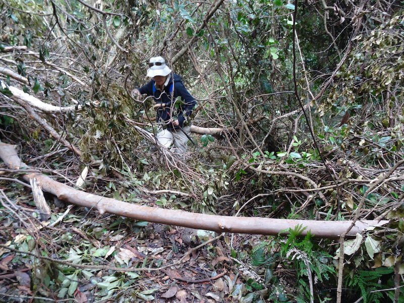
We were soon into our stride, on this lower smooth section.


About 2 k's in, the wooden steps disappeared and the trail roughened as expected.

Halfway - our first coastal view towards Byron Bay, Australia's most easterly point.

Further up, a hint of what was to be in store later.


Rachel pausing on the chained section.

If only this photo showed how perpendicular this length was!

There was time to catch one's breathe on the final, definitely more level, 50 metres to the summit.

The summit - three short tracks lead to 3 metal viewing platforms.

Main platform, facing east.
The panoramic view that greeted us.

Well into recovery mode from our 2 hours of climbing.

Murwillumbah / Tweed Valley.

View north west across Mt Warning's caldera, to the Lamington Plateaux. 

View south and still the sweep of the caldera walls.

The trail up had been busy with hikers returning from viewing the first rays of the sun to hit Australia. [about 6.30 am.] We were also regularly passed by those, of a much younger age than us, making their  energetic ascents. This created a great camaraderie on trail, as we plodded along at our own pace. 

I have just been speaking with Penny. [1993] Her son Worrin, now 29, quite often drives down early morning and is up and down in 1hour and 40 mins!

60,000 climbers a year make the expedition to the summit. An average of 164 per day. On this Sunday trek, the numbers would have been well over that. 

It was about midday when we commenced descending. The queue on the chained section was impressive, especially the numbers of quite young and enthusiastic children.


I found the descent quite relaxed, with time to enjoy our surroundings.


3 1/2 hours later, we were shedding our boots in the car park and feeling quite elated by, our not too demanding, achievement. A short drive later we were sitting in the cafe of the Tweed Valley Regional Art Gallery, enjoying some tasty refreshments. The view was just perfect.


When climbing, I often give a thought to the ones who first made it to the summit and then to those who had to create the trail for us to so easily access it. Their stamina is mind boggling and I am extremely grateful to have been able to have had the opportunity to meet the challenge of Wollumbin. 

Food for thought - a sign at the summit.

Glorious View
While your climb may have been tough, it
was easy compared to earlier ascents. In
 1871, botanist Michael Guilfoyle took three 
and a half days to reach the top. The effort
 was well worthwhile......

"When we reached the top we were so
enchanted with the glorious view that we
quite forgot the inner man, remaining on top
 all night without food."

I would love to read your comment.