Friday 26 September, 2015
Blakey Ridge to Egton Bridge - 19.5 kms
6 hours walking
On departing the White Lion at about 9am, we thought the time was much earlier, as the sky was low, dull and eerie.

The day commenced with a couple of k's road walking up Blakey's Ridge. At the summit, we turned right onto a narrower road. Looking across the heather we could see the quite famous, Raph Cross. [Used on the National Park's logo.] It was one of many ancient stone crosses and boundary markers that we have been spotting in this area.
Further along this road, we stopped to visit the 'Fat Betty' marker. Fat Betty is a white, cubed shaped rock, just over a metre in height, with a round head. A cross is carved into the head. Legend suggests that 2 nuns and a servant got lost in fog and were eventually found dead. The stone was set up to commemorate them. Tradition requires one to both take and leave a snack or a sweet.
I prefer the tale of a local farmer and his wife crossing the moors on a dark, foggy night. When the farmer arrived home, he realised that his wife, Fat Betty, was missing and that she must have tumbled from the cart. He went back the way he had come but all he could find was this large squat stone. Poor betty.
One of the reasons I love this story is that my great Grandfather and his wife went to town in their horse and sulky, a journey of 24 kms. On his return, the family asked where my great Grandmother was. The reply, "Gawd bless me soul. I've gone and left her in town!" Thankfully this tale has a happy ending.
Soon we turned north onto an even narrower road, called Great Fryup and Blakey Ridge was now left behind.
Great Fryup is a corruption of the word 'Freya' [Norse Goddess] and 'hop', the old English word for remote valley.
Great Fryup is a corruption of the word 'Freya' [Norse Goddess] and 'hop', the old English word for remote valley.
Along Great Fryup road, we could see the disused shooting lodge of Trough House, but it took an age to find the rough track which would take us passed Great Fryup Dale and onto High Dale.
The trail now took us on a gradual descent to Glaisdale Moor.
View to Great Fryup Moor, [left] Tough Gill Beck [middle]and distant Glaisdale Moor.[ far right]
View to Great Fryup Moor, [left] Tough Gill Beck [middle]and distant Glaisdale Moor.[ far right]
The heather here appears dead, but areas are burnt off regularly to promote healthy growth and seed germination.
The views were stunning in all directions.
I'm not complaining, but how magnificent would it be, on a blue sky day!
Just before our descent took us into Glaisdale, we entered farmland. I loved seeing the range of tractors.
Glaisdale appears to have a lofty perch above the Esk Valley, but its houses sprawl quite steeply down to the river. The terraced houses were built for the ironstone workers of the 19th century.
We were glad the teahouse was in the upper section of the village. Here we enjoyed another delicious cream tea and the peaceful view.
Such a pretty village.
We were regularly spotting bicycles hanging on houses and posts. Finally we gained the explanation that the 2014, Tour de France started in Yorkshire, hence the bicycle displays.
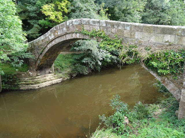
The graceful stone arch of the pack horse bridge, over the River Esk, is known as the Beggar's Bridge.
Beggar's Bridge
There's a well-known local tale of romance attached to Beggar's Bridge. An inscription on the bridge suggests that it was built in 1619, and the initials TF refer to Thomas Ferries, the son of a moorland farmer. When he was courting he had to ford the Esk to meet his young lady, Agnes, whose father considered Thomas too poor for his daughter. Thomas resolved to seek his fortune at sea but, with the river in flood, was unable to cross to kiss his sweetheart goodbye. Returning later, a wealthy man, Thomas married Agnes and built a handsome bridge on the very spot.
Nearby was a not so graceful, but very user friendly footbridge, which prevented our feet from getting wet crossing the causeway.

The last 2 kilometres of the day, took far longer than expected, as the path through East Arncliff Woods, beside the River Esk, challenged us with some steep ascents and descents. It was pleasant under the canopy of green.


We had read that Egton Bridge was 'a strong competitor for the accolade of prettiest village on the Coast to Coast.' We did find it charming with its lovely pubs, stepping stones across the Esk, sign to an old Roman Road, and its historic St Hedda's Catholic church.
The village was the home of the martyr, the Blessed Nicholas Postgate who was hung, drawn and quartered in 1679, during the last period in Britain when Catholics were legally put to death on account of their faith. The church houses his relics and striking stained glass window is dedicated to his memory.
The village was the home of the martyr, the Blessed Nicholas Postgate who was hung, drawn and quartered in 1679, during the last period in Britain when Catholics were legally put to death on account of their faith. The church houses his relics and striking stained glass window is dedicated to his memory.
Horseshoe Hotel

Roman road sign


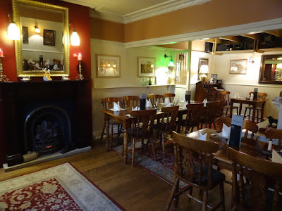
We arrived at The Old Mill B&B just after three. It was extremely comfortable and spacious. Plans had been made to meet fellow hikers for a meal at the Postgate Inn at six. We took a stroll through the village, visited the church and arrived at 5.45 to find the Inn closed. There was no signage for its opening hours but we waited, hopeful it would open at 6. Pub times in England are quite difficult for Aussies to get used to. The doors did open, but as I recall much later. It was worth the wait however, as the interior was charming and the food delicious.
The only menu
It wasn't a late night as tomorrow was our final and longest day - 28 kms.!
We knew we would have to repeat our motto often.
"It's not the distance. It's the journey"
We knew we would have to repeat our motto often.
"It's not the distance. It's the journey"
The sun never quite managed to shine brightly, but it was certainly a tad warmer than it was for the Walking Gardner, who hiked the C2C in March, 2013. Here is a link to his day, if you are interested.
I would love to read your comment.


Love the last photo of the three of you looking ahead. Again, another beautiful walk through outstanding countryside and cute villages. Thanks for taking us along!
ReplyDeleteSuch an enjoyable post. So much to see and photograph. I could spend many days there. Or at least-- I wish I could. :)
ReplyDeleteWhat an enjoyable read and lovely photos. My favourite is the one crossing the creek over the large stepping blocks.
ReplyDelete