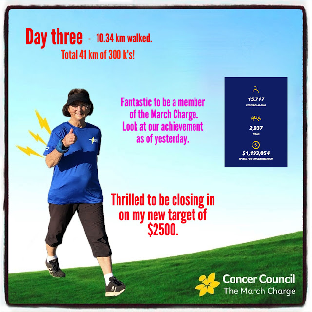
My Facebook post of February 18, read:-
Sharing laughter and friendship whilst hiking in SE Queensland's National Parks.
Tuesday, 5 March 2024
Walking with a Goal
"Late December, my younger brother Jim, was diagnosed with B-cell Lymphoma. On the 15 January, the day Jim had his first chemo, I read about the Cancer Council's 'March Charge', ie walking every day throughout March. In the past few years too many of my friends and family have had to take the cancer journey. My eldest brother David, and dear friend Leslie, both passed away in October last year. I immediately signed up to walk 300 km and raise $500, but I would dearly love this amount to reach $1000 or beyond. I will be very appreciative of any support you can give me towards this goal."
It turned out that I was among the first to register and I received a March Charge shirt, almost immediately.
My post, two day's later, (Feb20).
"I'm feeling incredibly grateful to have almost reached $1000 in donations towards my 'March Charge' for cancer. I am now optimistic that I may be able to reach $2000.
Please donate any amount, big or small, to help tell cancer where to go!"
February 25
March 1
Unfortunately the temperatures for the past two weeks have been in the low 30's, with intense humidity! Leaving around 5 to 5.30 am the temperature is around 23 C. I walk for about half an hour before the sweat starts dripping.
This is what I posted at 5.21 am, just prior to my walking out the door.
My route was part industrial estate, part suburbia and the latter leg, my usual morning track. It was amazing to have birdsong accompany me. I was delighted by the numbers of Super Fairy Wrens all along the way. I wish they were resident in my garden. Just over halfway I stopped at my friend Janice's, where we shared coffee and a lovely chat. On arrival, her regular visiting Kingfisher was sitting on her pool fence. Just so special to see. He didn't want to be photographed though!
Day 2 saw another early start, but a much shorter route using my local paths.
The Kookaburra laughing.
And taking breakfast a day later!
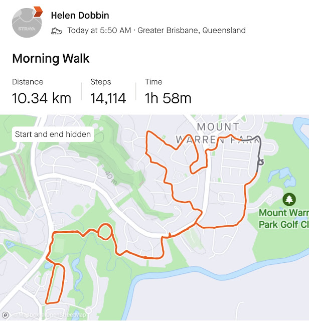
Day 3 - local.
A cool start, but light rain overnight soon had the humidity rising. I didn't walk as far, as I had a big day planned for the following day, Monday.
Day 4 - along the Brisbane River.
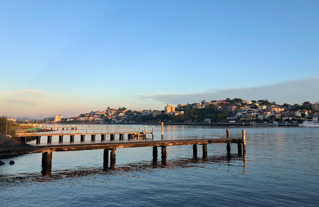
5am saw me in the early morning commuter traffic, destination Apollo Road Ferry Terminal. Although the traffic was heavy, there were no delays and I was soon witnessing the early morning light on the river, as I awaited the ferry's arrival.
The ferry took me across the river to Brett's Wharf, where my 'day 4 Charge' commenced. The recently modernised river trail was abuzz with locals taking their morning excercise. My eyes were drawn to the light on the river and the foggy mass hanging over the city skyline.
Oddly, noone to be seen in this image as I take my first steps along the path.
My original plan was to walk as far as I felt comfortable along the northern shore of the river. As I set off, I made the decision to criss-cross the river, using as many of the bridges as possible.
Many of you will be very familiar with the beauty of our river from previous posts and especially from a recent post.
Yowoggera Bridge over Breakfast Creek
First 3 k's done, and a pleasant shady spot to eat a delicious french pastry.
7 km view.
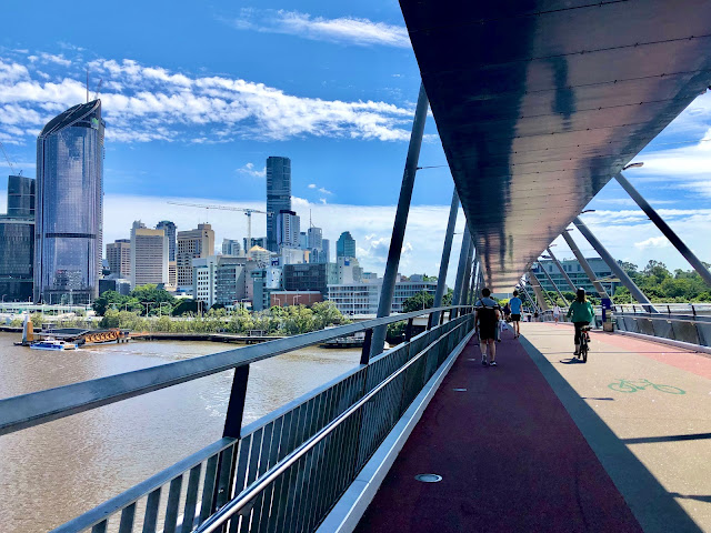
Approaching and entering the nearly 900 m Brisbane Riverwalk, [boardwalk] with its wonderful views of the city skyline.
Brisbane's Story Bridge - (1940) A lift swiftly lifts one from river level to bridge level.
Kangaroo Point Green Bridge - its construction is progressing well for its opening later this year.
This Google map image may help you follow the remainder of my walk.
On crossing the bridge, I circled back to the Medly Cafe for a coffee and scone. 11 km completed. The Riverwalk can be seen opposite.
Refreshed and phone recharged, I walked under the Story Bridge towards the Kangaroo Point Cliffs.
A closer view of the Green Bridge.
The view up river to the pedestrian-free, Captain Cook Bridge (1972) and freeway into the city.
The view up river from under the Captain Cook Bridge. Four bridges are in the distance.
The clock tower of Sommerville House, a very prestigious private girl's school. The white cloud mass caught my eye, nature's tower.
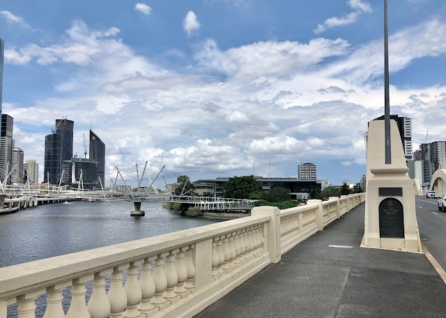
Crossing the Goodwill Bridge (2001) which connects Southbank to the City Botanical Gardens and city precincts. [pedestrians and cyclists only.]
The view up river from the Goodwill Bridge.
In the foreground is the Neville Bonner footbridge, also due for completion this year.
Having crossed the bridge, I was able to continue up river along the waterfront. I passed under the Goodwill Bridge and on reaching the Victoria Bridge, (1874) I climbed steps that took me to road level and access to the city centre. Here I found an air conditioned foodcourt for light refreshments, before continuing across the Victoria Bridge seen below. It has only recently been designated a bus and pedestrian bridge. All part of readying Brisbane for the 2032 Olympics.
Concert Hall on the left and Museum on the right.
A view of the Kurilpa pedestrian bridge. I would access it by walking past the State Museum, Library and Art Galleries, seen on the LHS of this image. Behind the Kurilpa Bridge, one can just make out the arches of the Grey Street Bridge..
The Kurilpa Bridge. (2009)
Its name comes from an Indigenous name for "place of water rats". It links Kurilpa Point to the city.
Grey Street Bridge (1932)
On the RHS you can see the arches of the cross river rail bridge. There is a road toll bridge open to pedestrians, just beyond the rail bridge, (1978) but the heat and humidity were finally getting to me. On crossing this bridge, I made my way to Southbank and the ferry terminal where I would conclude my walk.
The grey sleeves I am wearing are a new purchase. UV protection and very cool to wear. The brown scarf is a cooling scarf. Dampen it. Shake it and wrap around the neck. Bliss. The blue buff on my wrist, wipes the sweat from my face. I did have a wide brimmed walking hat on, for the duration of my walk.
A relaxed, breezy, ferry ride had me back at Apollo Road and my car, in 50 minutes.
1.05 pm view up river. Storms were building and we would receive 28 ml in a late storm and overnight.
It had been a long walk, but taking it in stages and resting sensibly in shade several times, I completed the distance feeling invigorated by my effort, and so very grateful for the good health allowing me to enjoy our wonderful city.
I add my 'March Charge' donation page for any Aussie reading this post, who might like to sponser me. Even the smallest amount is greatly appreciated.
https://www.themarchcharge.com.au/fundraisers/helendobbin?fbclid=IwAR1TiWXTCcPSFnRyZoZiB4XrsipDK9RMlnRx0IF68TJYLlZA2d7-juUIv14
Yesterday I walked a further 12 km with a Gaiter Girl friend and today the Hungry Hikers helped me add another 10.
Total kilometres - 84
- 214 to complete by March 31
Donations to date $2310
I would love to read your comment.
Sunday, 25 February 2024
An Alpine Paradise
Seefeld, 20 to 25 May 2011
Alexandra, of 'Still Making Waves on Top of the World', is off hiking in Austria in a few months time. This news sent me racing for my diaries and photos of our May 2011 visit.
We had just spent 7 days hiking in Slovenia in the Jasna Lake area, Ukranc area and Bled area. We took the train from there to Innsbruck. Then a small train took us 18 km to the higher plateau and Seefeld. Finally a bus dropped us at the door of our accommodation for the following 5 nights.
Xander Hotel in the Leutasch Valley was our full board, accommodation.
Front entrance
Everyone sat down to dinner ar 6.30pm. As it was Saturday night on our first evening, we dined with this wonderful trio playing in the background.
I was in alpine heaven! After dinner I was able to take a short walk around the village in the wonderful, evening light. Frank unfortunately, had developed bronchitis before we left Bled, so was limited in how far he could walk during the early part of our stay.
Day 1 - local strolls and a visit to to Seefeld.
A path out of Seefeld from St Oswalds Church, led us to a knoll and a circle of 12 massive stones representing the Apostles.
My evening walk.
With a backdrop of snowcapped peaks I meandered through fields of buttercups and ranunculi, in the crisp alpine air, accompanied by birdsong and watching the peaceful, grazing sheep and goats. A farmer and his little daughter stopped for a chat. Sheer bliss!
Day 2
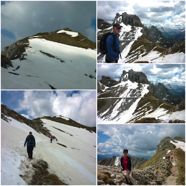
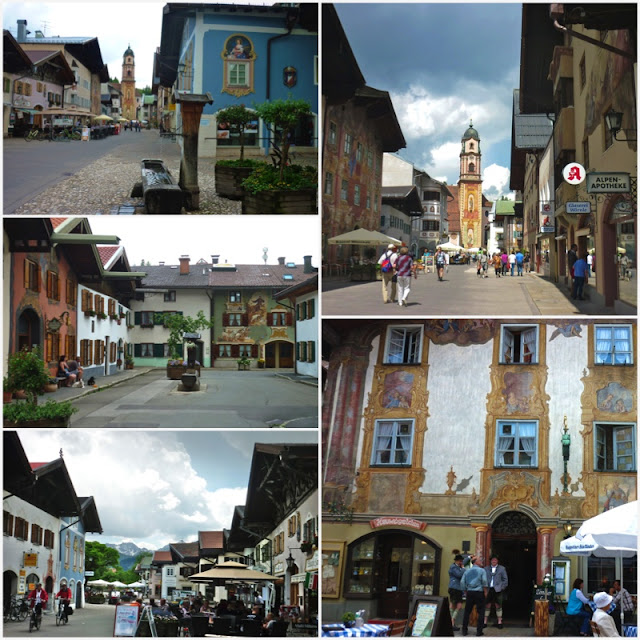
Looking for something less strenuous for Frank, we took a 25 min bus ride north into Germany and the quaint town of Mittenwald. [933 m] We discovered that Mittenwald is famous for its colourful, painted houses and violin making. Our intent however was to find the town's gondola. Soon we were being whisked steeply to 2244 m. We assumed that at the top we would walk lazily, through lovely Alpine meadows!
Ha, ha, the ignorance of Aussies!
Photos on the RHS above, taken from here.
We then turned right to make the circular climb back to the gondola. Alas my body froze halfway up the slope and we had to retrace our steps.
Aah, the joy of seeing alpine flowers, so often read about in novels.
View back to the gondola..
Beautiful Mittenwald - it was Sunday and it seems that the locals enjoy being out and about in their national dress on this day each week.
As we waited to take the bus back to Leutasch, the storm that had been threatening all morning materialised in full force. The heavens opened, thunder echoed through the valley and hail fell. Thankfully we found shelter close to the bus stop.
Day 3
We woke to a dreary looking day and the weather channel didn't give much promise for any improvement. At 9.30 we set off walking to Seefeld via trails 3 and 42. Joined by Englishwoman Wendy, we changed course for Wildermoossee. Lovely woodland with lots of up and down to Lake Wildmoossee.
Here we veered towards Mosem. A fairly steep climb gave us views over Seefeld and its ski jump, before we arrived at another lovely lake.
We now climbed down towards Mosern. From its Peace Bell, we were able to look down into the wide Inntal Valley in which Innsbruck is situated.
The Peace Bell marks the 25 th anniversary of the Alpine Work Group. It symbolizes cross border peace initiatives between the people of the Alpine Area. Weighing over 10 tonnes, it is swung daily at 5 pm.
From the bell we were looking across the Inntal Valley, to the area where Alexandra will be visiting.
Time to make our way back to Seefeld and catch a bus back to Leutasch. About 18 km had been walked. Frank's antibiotics bought in Bled, had kicked in.
Day 4
Greeted by a lovely sunny day, we took the Miitenwald bus again, but on this occasion, alighted at the entrance to the Leutasch Gorge, just south of the German border.
Our pre reading prepared us for a mysterious watery realm, owned by the fairies and goblins that live in the gorge, and where the water swirls in a fast moving torrent between high rocky cliffs. [75 m]
The gorge is 3 km long, with the initial trail being through woodland, leading to a complex feat of metal walkways, [2005] high above the foaming waters.
RHS - English companions from the hotel - Ann and Wendy.
The exit
The following two photos belong to the blog writer, "Heather on her Travels." They give a much better feeling of the gorge and the walkway.
On exiting the gorge we were in the Mittenwald Valley. We took the trail south to Scharnitz.
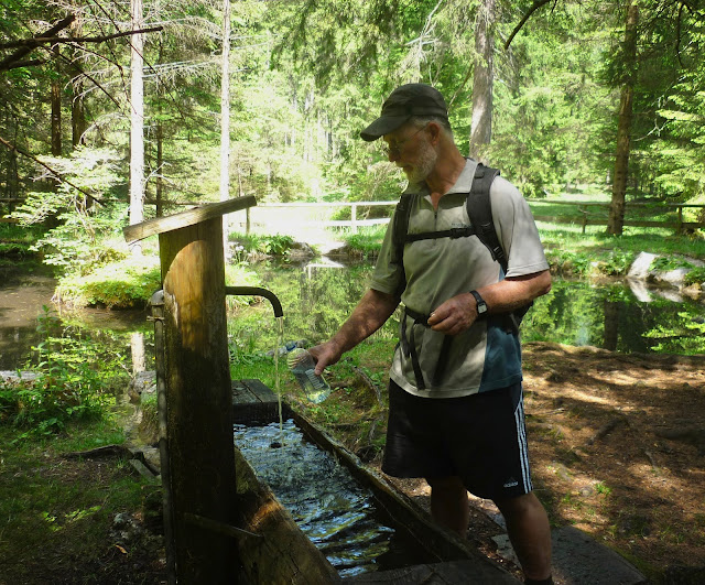
This trail was shady and flat, meandering through tall firs with an undergrowth of heath vegetation. I did spot some Lily of the Valley.
Leaving Schnaritz we had to make a decision about our route home. We had little information to guide us and chose Route 18 to Ahrn. The notes didn't explain that the trail wasn't well sign posted. That it was steep and narrow in places, or that it was used infrequently. A very challenging couple of hours followed. At the end of the day however, we had successfully 'conquered a mountain'!
Initially the trail meandered slowly upwards on a road. It then gradually increased in steepness, turning into a very narrow track. All very pleasant until we entered 'mountain goat' elevation. The zig zagging track dropping steeply on either side was not pleasant at all. It was too late to turn back. Eventually the trail flattened but we were still climbing! There are no photos of the worst sections. I wonder why?
The final 3 km from Ahrn to our hotel was blissful walking, surrounded by flat, alpine meadows.
Our stay here was over. The following morning we caught the small train back down the mountain plateau to Innsbruck. A fast train then sped us through the Inntal Valley towards our next adventure. The alpine walking wasn't quite what we had expected, but we had most certainly enjoyed every moment and alpine view.
I would love to read your comment.
Subscribe to:
Posts (Atom)


